
| This is Dare's GPS/GIS
page. It provides a place for me to document some of
the love I have for mapping and technology. My life-long
journey started with 'paper' maps and globes, including a
large collection of National Geographic maps, and has now
progressed to the point that GPS devices are common in
many everyday devices. Using 'open source' software
to manipulate and display geographic data just makes the
whole experience so much the better! :) |
|
GPS CONFLUENCE ADVENTURE
GPS
GEOCACHING
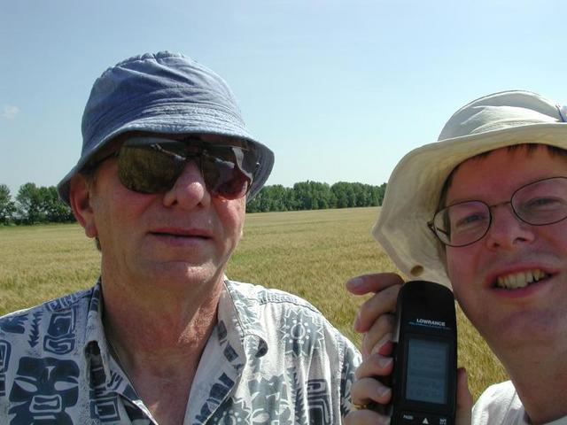
I have created my own public 'geocaches' for others to find and enjoy!
Check here for other geocaches stored around Morden. Using the great program Maemo Mapper on my Nokia N800 with a Holux GPSlim236 GPS receiver, I was able to upload a test 'gpx' track file to two cool sites: Lake
Minnewasta South Trail at EveryTrail
Lake Minnewasta & Minnewasta Golf at EveryTrail Lake Minnewasta Dam at EveryTrail Maps
created by EveryTrail:GPS Geotagging
|
|
Here are most of the GPS devices
that I currently own:
|
 Some links to GPS stuff: |
| Here is an OpenLayers
map showing plotting the location of a GPS on my
yard over the last 1000 samples (red 'blotch' in
lower center of the map). This was done by running a gpsd background task on one computer with a Rayming TripNav TN-200 USB GPS 'mouse' connected. The webserver computer running these webpages then communicates on port 2947 with the gpsd background task, and gpxlogger converts the data stream into GPX (GPS Exchange) format, which then can be processed with javascript displaying an OpenLayers map. Notice the 'wobble' illustrating the 10 meter inaccuracy of consumer-level GPS receivers: For a full-screen view, click here. |
|
Current text-only magnetic declination (deviation of magnetic north from true north) at the home of Dare, in Morden, Manitoba, Canada: |
|
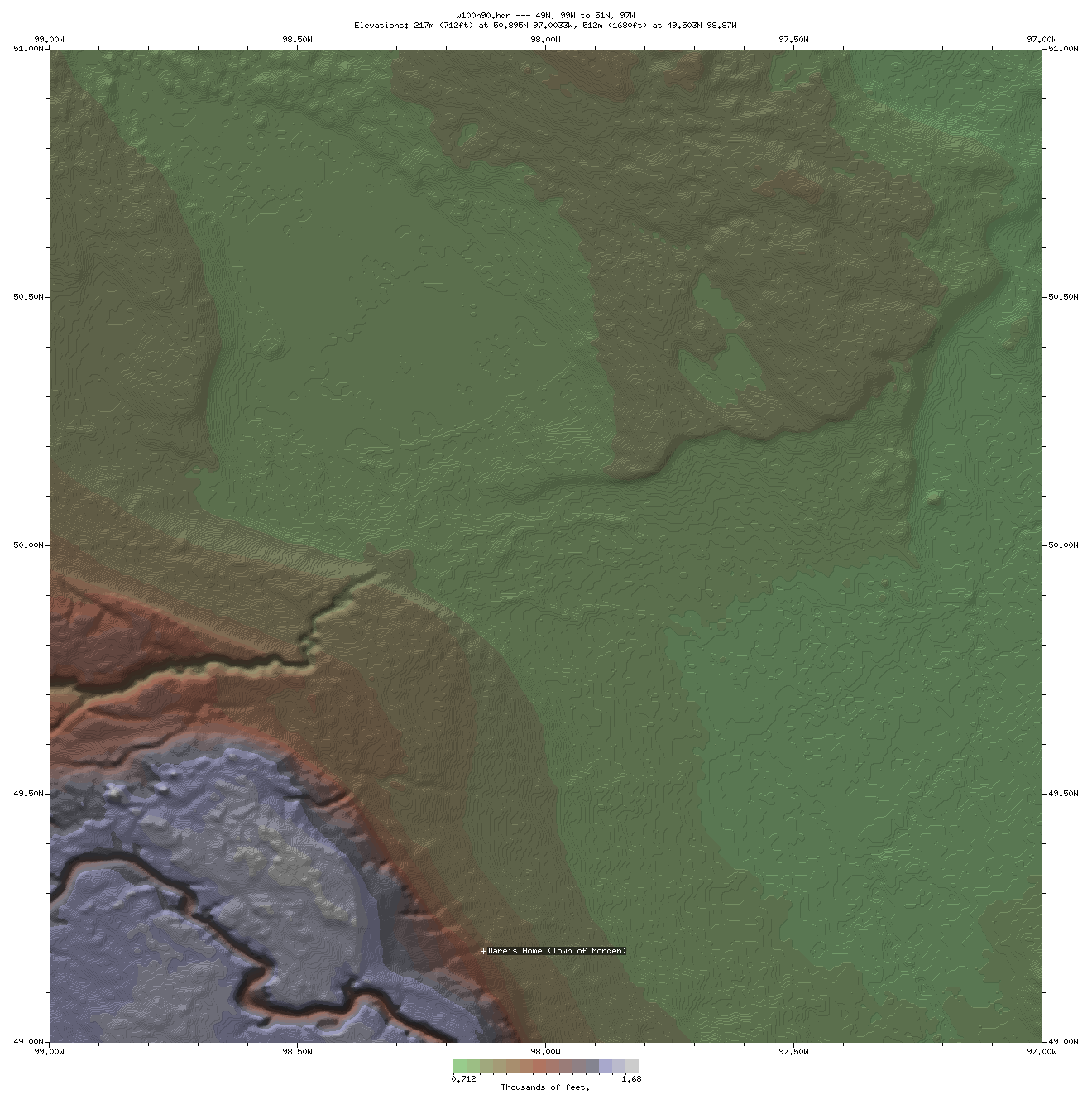
DEM (Digital Elevation Map) of southern Manitoba using GTOPO 30 arcsecond data (W100N90 found at USGS EROS Data Center) using drawmap software: Using the same drawmap
software except using the new Shuttle Radar Topography
Mission (SRTM) 30 arcsecond data
(W100N90 found at the USGS
SRTM ftp site):
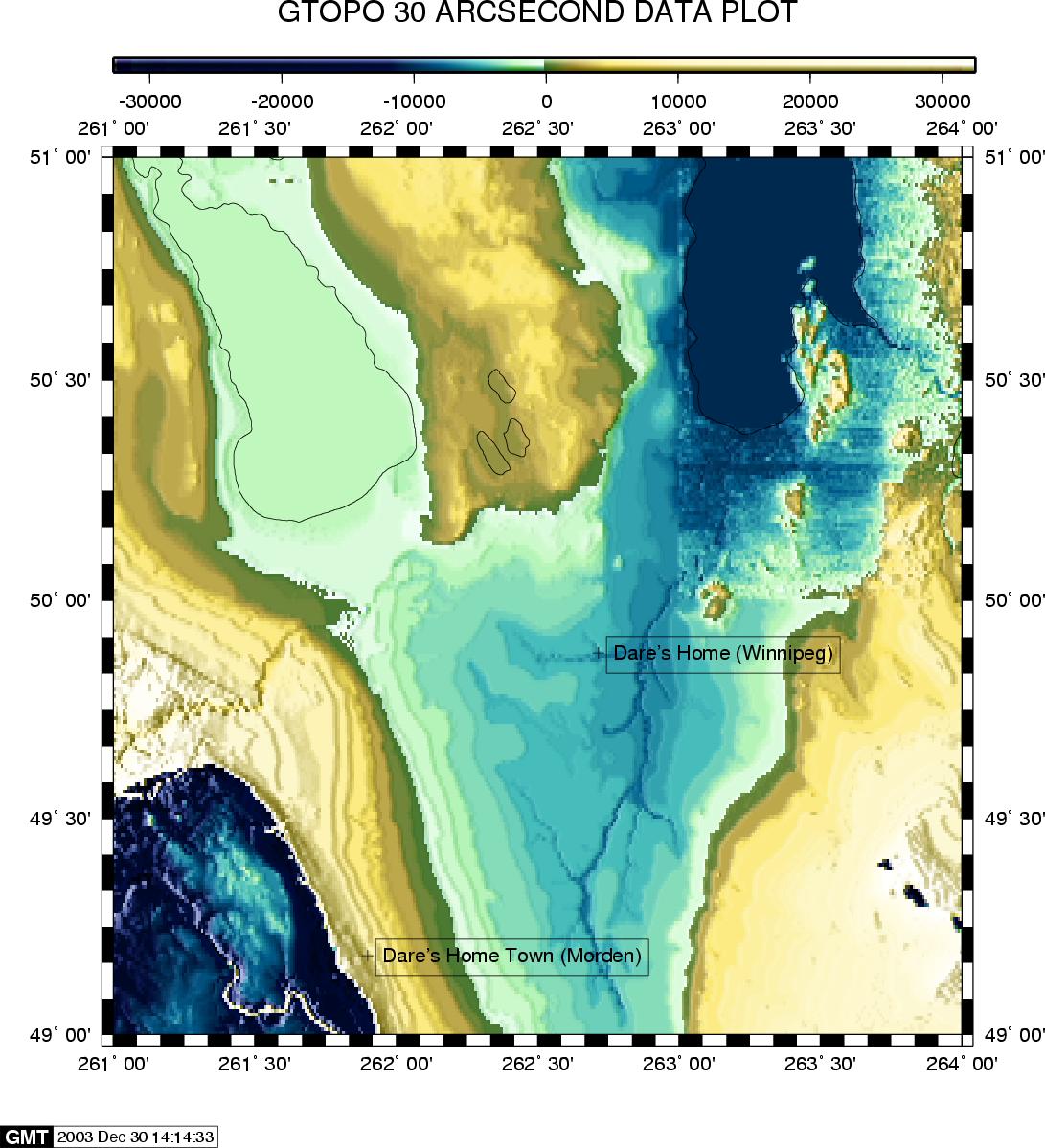
The same GTOPO 30
arcsecond data plotted with the
extremely powerful (and complex) Generic
Mapping
Tools (GMT) package:
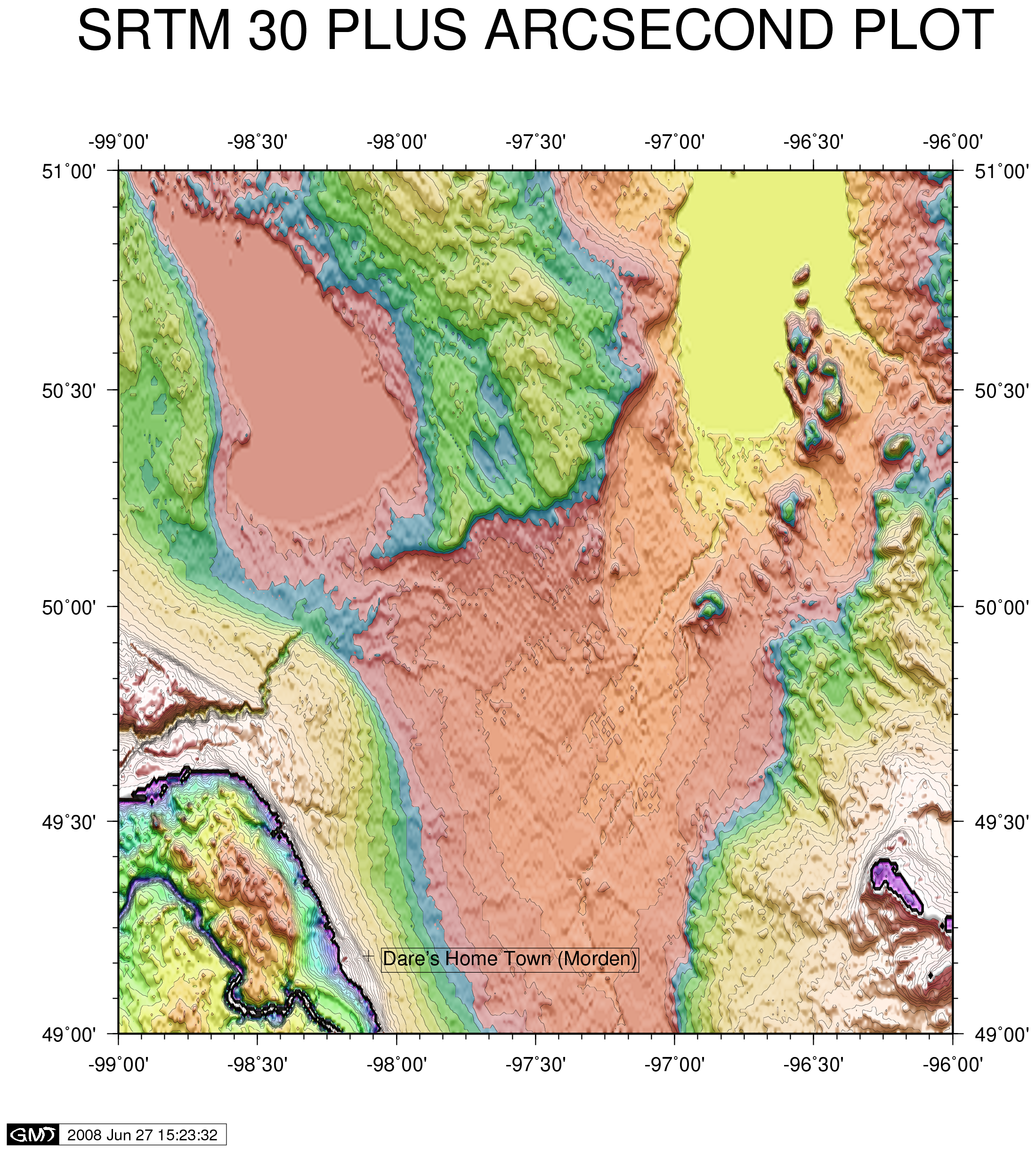
NEW! Using the special hybrid SRTM30Plus data of the same area:
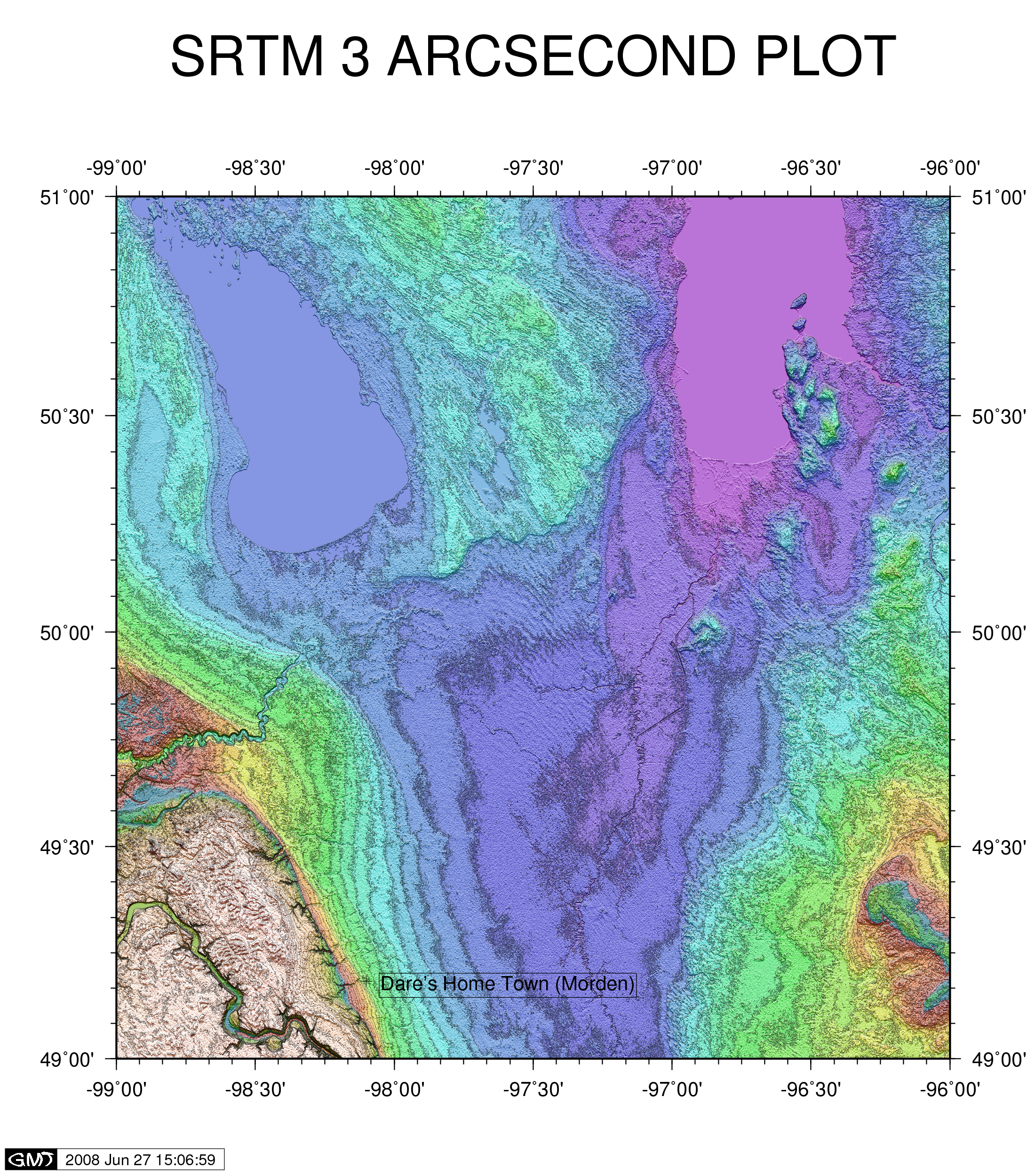
Using the same GMT
package, here is the same map plotted
using the high resolution Shuttle
Radar Topography Mission (SRTM) 3
arcsecond data (N49W097, N49W098,
N49W099, N50W097, N50W098, N50W099
found at the USGS
SRTM ftp site):
Notice the dramatic
increase in resolution when comparing
the GTOPO30 arcsecond data to the SRTM
3 arcsecond data! Click the
images above to view larger versions. GTOPO/SRTM 30 arcsecond data
resolution = 1000 m Special thanks go to Robert Fromm for giving me the tips I needed to get started with SRTM data and the GMT software! NEW! Here is the same SRTM 3 arcsecond plot again, using newer data and a new version of GMT:
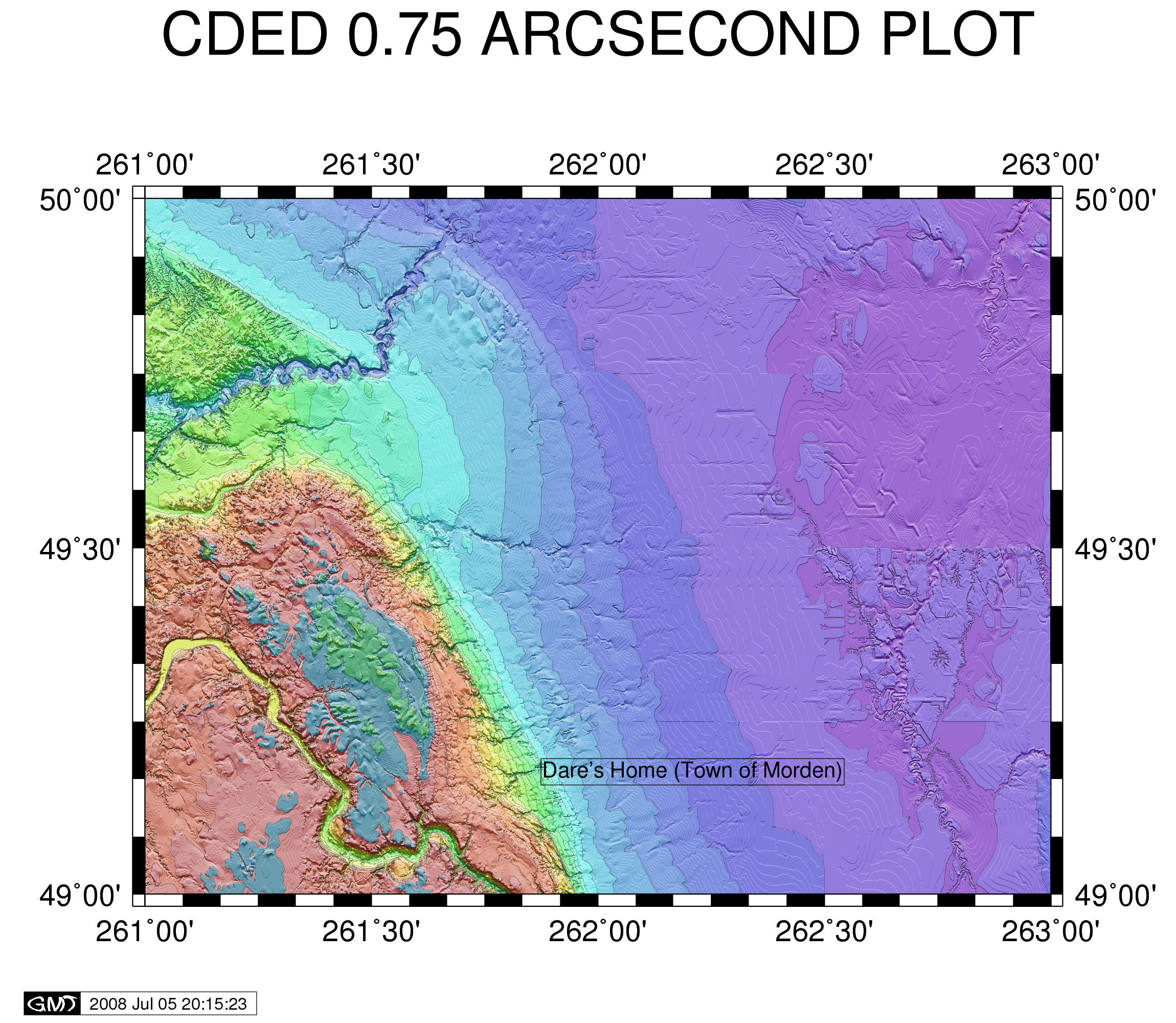
New!
Using CDED
(Canadian Digital Elevation Data), I am
able to match and exceed the SRTM data
that is available for Canada:
CDED 3 arcsecond data resolution = 90 m CDED 0.75 arcsecond data resolution = 23m First, here is an image on the same scale as those above, with the 1:250000 data (3 arcsecond/90m): 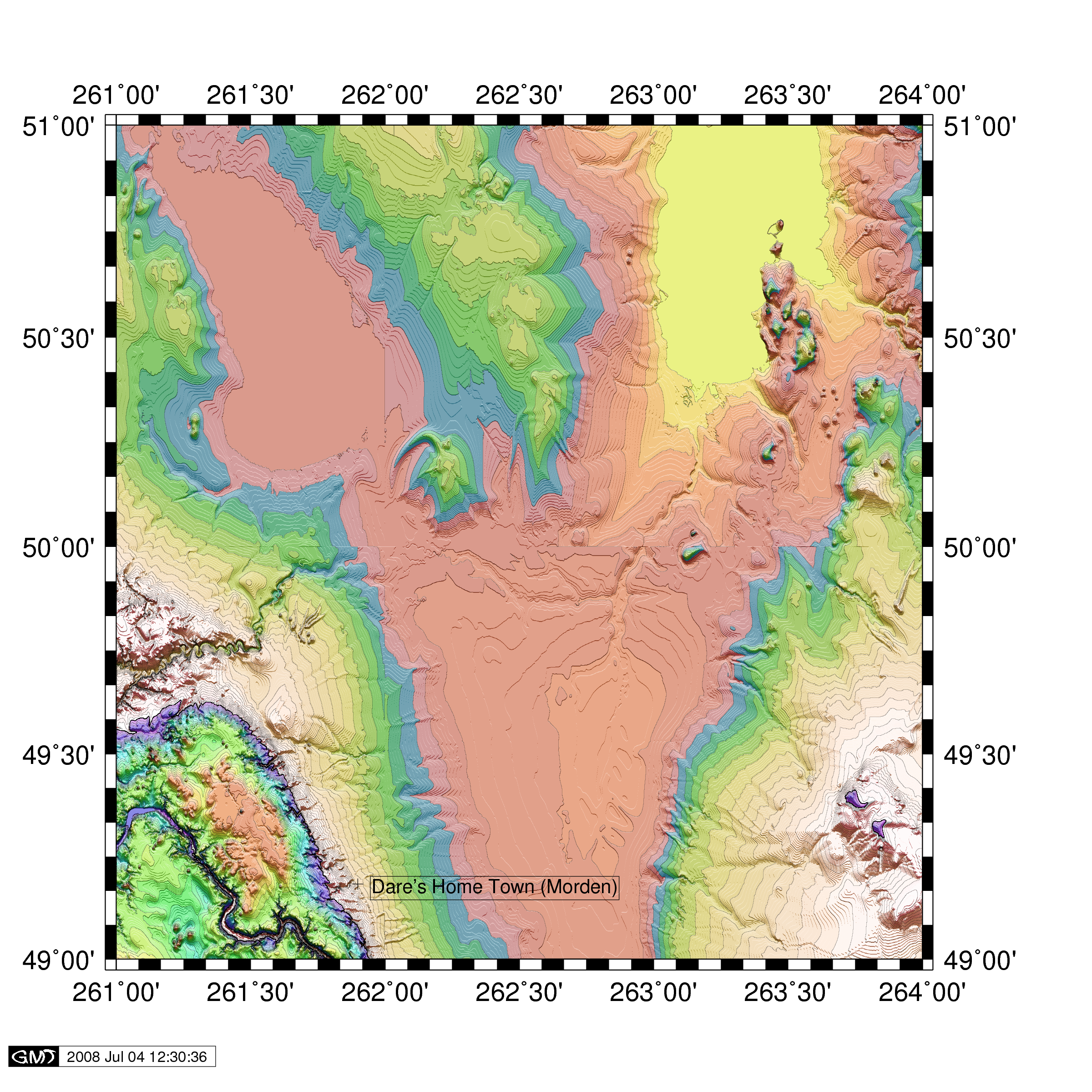
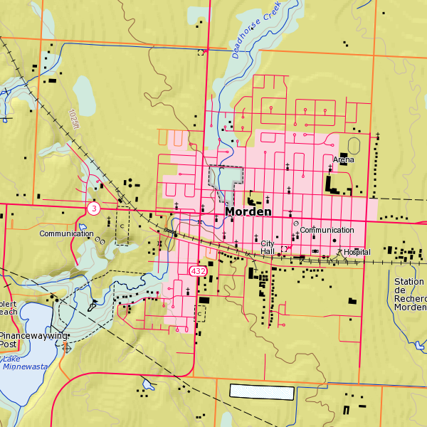
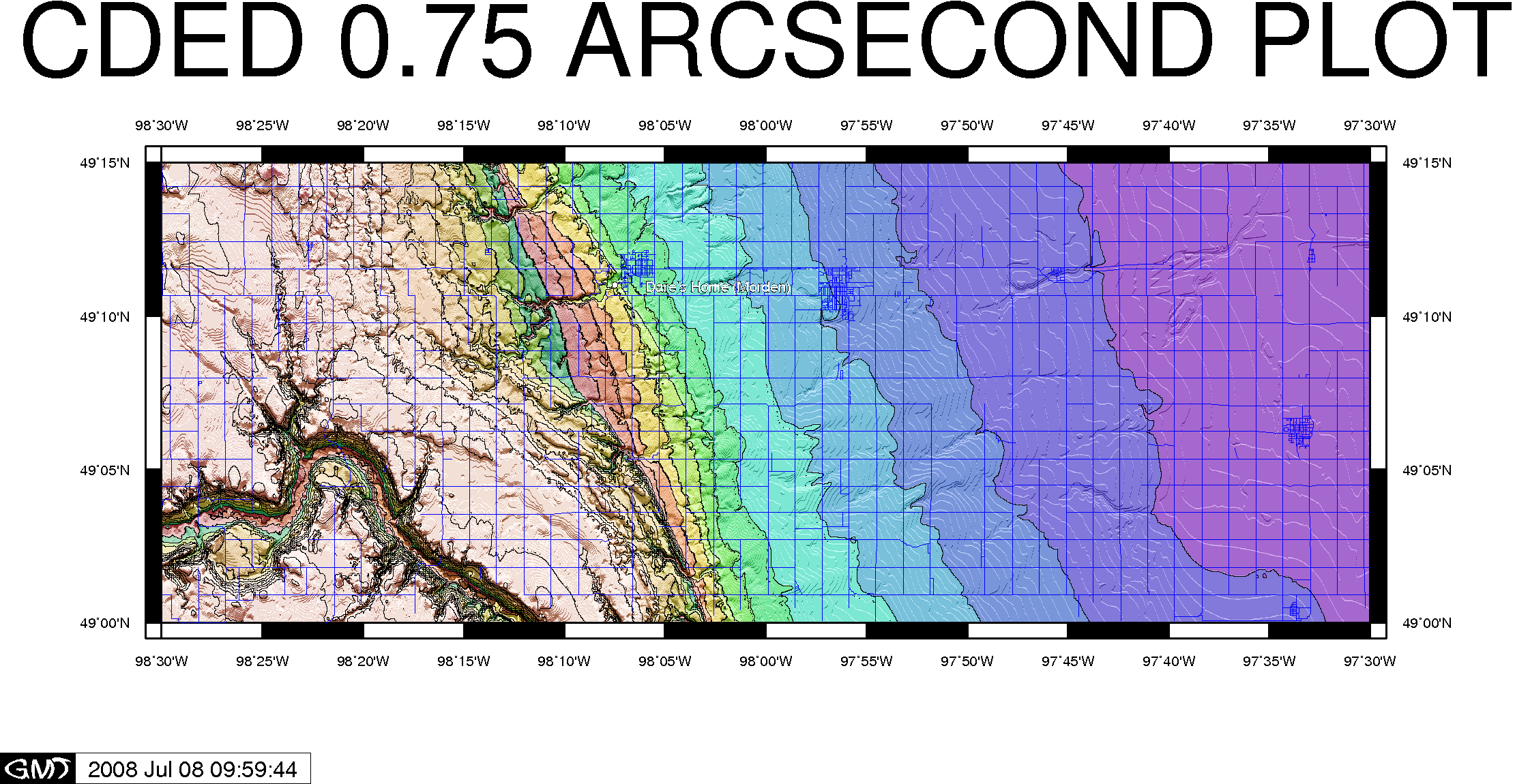
NEW! A zoomed-in area of particular interest i.e. Morden/Winkler area, also with the same 0.75 arcsecond CDED data, this time overlayed with NRN (National Road Network) data also from GeoBase:
|
|
Here are
some other maps that I created using GMT:
AZIMUTHAL EQUIDISTANT
MAP CENTERED ON MY HOME
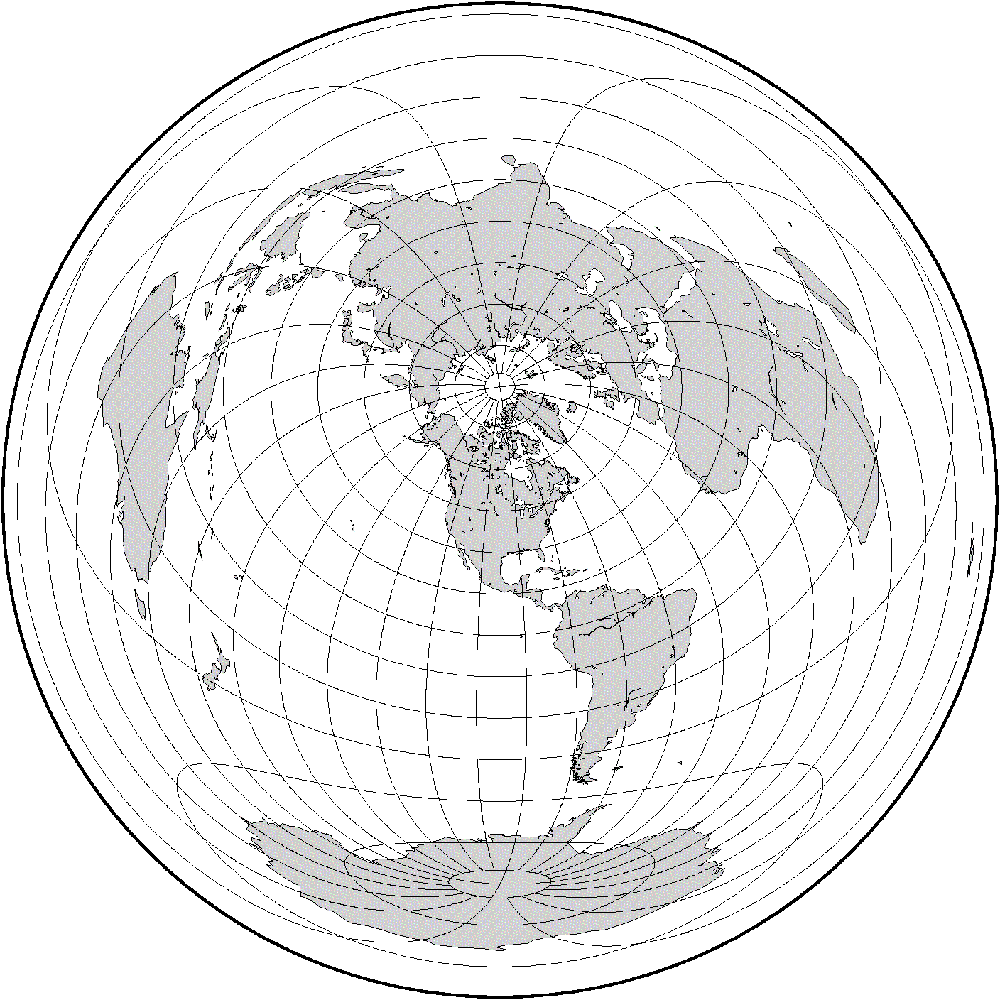 pscoast -R0/360/-90/90 -JE-98/49/7i -B15g15 -Dc -A1000 -G200 -W0.25p -P > GMT_az_equidistant.ps ORTHOGRAPHIC MAP
CENTERED ON MY HOME
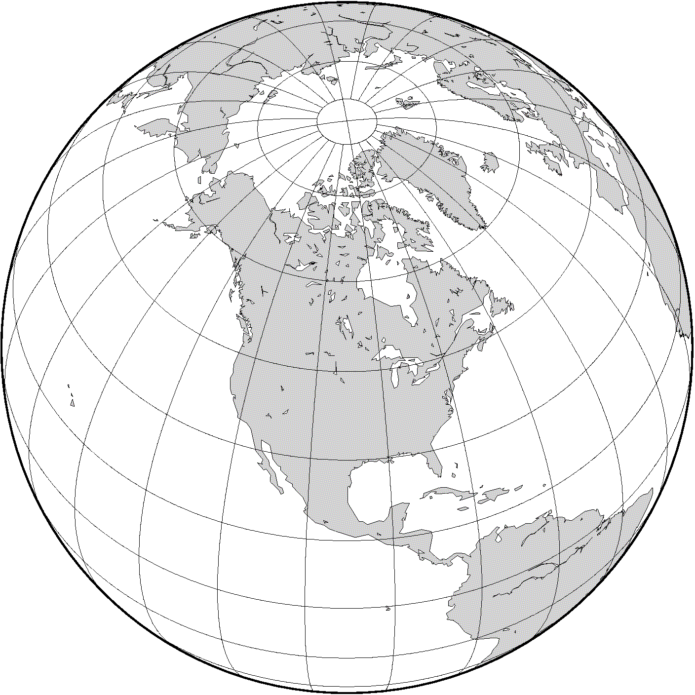 pscoast -R0/360/-90/90 -JG-98/49/7i -B15g15 -Dc -A1000 -G200 -W0.25p -P |
Here is a
link to some other webpage maps that I have
created on my site:
|
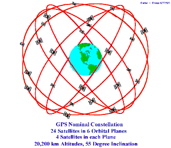
| 2017 New! Not only are GPS satellites and amazing provider of location information for the world, but their technology relies on highly-accurate on-board Cesium/Rubidium atomic clocks -- and these time sources are freely available to home computer users! See my Dare's Raspberry Pi Stratum 1 Time Server page for an example of a Raspberry Pi single-board computer that has this technology implemented. I have had success using both NEO-6M and NEO-7M GPS modules for these projects. |


